
| Home Info | Directions | Neighborhood | Floor Plan | Photo Gallery | Printable Flyer |
![]()
![]()
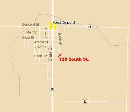
Maps and Directions
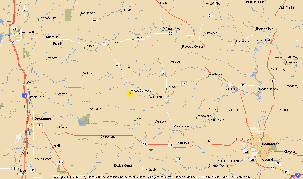
Here is a map of West Concord (courtesy Microsoft Expedia Streets 98):
To find out how to get here, you can go to Microsoft Expedia, read my directions (below), or view this map:
| Directions: If these don't help, just call and get more personalized directions. |
|
| From Rochester (and other Easterly points): | Take Highway 14 West past Dodge Center. After about a mile, you'll see a
sign pointing you toward West Concord and Kenyon along Highway 56. Go about 8 miles to West Concord. Take your first right directly after the Baseball park (which is on the left). This is South Street. Go all the way to the end of the street. We're the last house (It's a blue house) on the left. |
| From Owatonna (and other Westerly points) | Take Highway 14 East toward Dodge Center. You'll see a sign pointing you toward West Concord and Kenyon along Highway 56. Go about 8 miles to West Concord. Take your first right directly after the Baseball park (which is on the left). This is South Street. Go all the way to the end of the street. We're the last house (It's a blue house) on the left. |
| From the North | You can either come in along Highway 56 above Kenyon (accessible from
Highway 52 at Hampton), from Highway 52 near Zumbrota on Highway 60 toward Kenyon, or from
Highway 35 on Highway 60 at Faribault toward Kenyon. Once you get to Kenyon, head South on Highway 56. Go about 8 miles to West Concord. After going through town, take a left your first right directly before the Baseball park (which is on the right). This is South Street. Go all the way to the end of the street. We're the last house (It's a blue house) on the left. |
| From the South | Get to Highway 14. Then follow the directions for either Rochester or Owatonna, depending on which you are closer to. |